

By largely ignoring the urgent calls to action over the last three decades, humanity has arrived at the dangerous ‘find out’ phase of our collective climate experiment. While the threat of global ecological collapse is closer and more likely than any of us want to admit, we can still avoid disaster. Combining collaborative conservation with the power of new technology presents a path forward.
Locally-led collaborative conservation has proven to be a durable and effective way to enhance ecological and community resilience, both in the U.S. and around the world. In fact, it is so successful that the most frequent challenge is acceleration and expansion. New technologies, including high resolution geospatial data and AI-driven modeling, offer tremendous potential to accelerate and expand locally-led adaptation and conservation solutions.
This essay details a rationale for building a nation-wide stewardship decision support system with high resolution geo-spatial data and AI-powered modeling of impacts—essentially a digital twin of real-world ecosystems. This digital twin could give land managers, communities, and the general public the ability to model scenarios, explore alternative outcomes, track progress, and contribute to decisions that account for the diverse values of public landowners and enhance resilience.
New technologies, including high resolution geospatial data and AI-driven modeling, offer tremendous potential to accelerate locally-led adaptation and conservation solutions.
Creating this system is a Herculean task. The difficulties surrounding the cost, equity, accessibility, legality, governance, and maintenance of a decision support system for land management will require the combined creativity of experts from just about every discipline. But now is the time to start the discussions, debates, and convenings it will take to hammer out details and craft a robust strategy. With Earth’s life support systems teetering toward breakdown, we must embrace this sort of challenging, novel solution.
Climate disruption requires bold action now!
The current and growing harm from human-driven, rapid climate disruption is hard to underestimate and must drive bold, urgent action. We may have already crossed irreversible tipping points that threaten the basic stability of systems that make Earth habitable. While reducing carbon emissions could ameliorate climate disruption, given our current political and economic trajectory, the most likely future is 2°C or even 4°C of warming with a cascade of alarming consequences. The economic cost of climate disruption in the U.S. is nearly a trillion dollars annually and likely to continue rising. For example, the cost of wildfire management is projected to double by the end of the century, as will the cost of hurricanes, floods, droughts, and winter storms. We are significantly underinvesting in mitigating climate disruption. For instance, the US Forest Service estimates $11 billion and the Department of Interior estimates $35 billion in deferred maintenance. To make matters worse, our ability to invest is declining because of the nation’s growing debt burden and shrinking labor force.
Increasing costs and shrinking resources force triage, focusing scarce resources where success is achievable. To put it bluntly, we do not have sufficient money or people to make all communities resilient or to save all the threatened ecosystems. As distasteful as the idea of triage is, a realistic assessment of our options leaves us with unpalatable choices. Acknowledging the gravity of our situation is a crucial step towards solutions.
Locally-led collaborative conservation is essential
Collaboration, the explicit decision of diverse individuals and organizations to work in good faith toward shared goals by combining resources and with open decision-making, fosters effective and durable stewardship. Successful natural resource management collaborations have been documented for a wide range of issues including watershed health, conservation of threatened ecological communities, and wildfire mitigation.
Advanced technology is nearly useless without long-term, collaborative conservation that anchors it to local realities.
Personally, I have experienced the power of collaboration in the forests of the Southwest. In 2006, diverse groups codified their zone of agreement in restoration principles and built a shared foundation for action across New Mexico. Setting aside polemic positions and working with people of all perspectives for the health of our forests is energizing. Importantly, many of the same folks gathered again and again over years, often in the woods where conversations are easier. Standing together to see the results of different restoration approaches or the negative impacts of uncharacteristic, high-severity wildfire kept us focused on shared values. At the same time, local communities saw momentum and supported the progress. The first prescribed burn I assisted with drew intense community interrogation. The fourth burn brought community participation. I benefit from the tangible results of collaborative conservation everyday – the water I drink was protected from the 2020 Medio Fire by decades of collaborative watershed restoration, specifically the Pacheco Canyon Prescribed Burn.
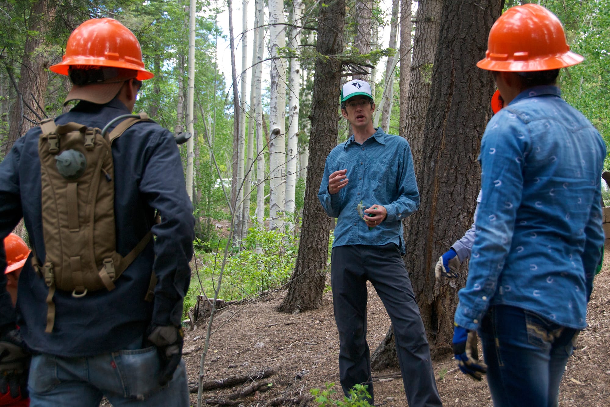
Of course, issues and disagreements over public lands management remain, but with so much work to do in areas where we agree, the divisive topics are less important. In addition, the disastrous toll of drought and high-severity wildfires continue to incentivize working together and demonstrate the consequences of inaction. Locally-led collaborative conservation is one way to connect “nature loss to the kitchen table issues that keep working class people up at night,” which Amanda John Kimsey’s recent essay argues is crucial for durable progress. The most radical voices on either end of the spectrum still stoke conflict, but, because most practitioners and residents work in the zone of agreement, absolutists fail to incite discord.
Collaboration is not easy. It is slow, costly, and sometimes painful. Participants deal with meeting fatigue, turnover, and shifting funding. However, as Lynn Scarlett’s essay Collaborative Conservation in a Time of Discord eloquently states “locally-led problem solving and cooperative decision making may not be an easy or glamorous solution, but it is the only way to tackle the big challenges facing our public lands and waters.”
New opportunities emerge from combining advanced technologies
I’m convinced locally-led conservation like I’ve seen in New Mexico is essential for effective, durable results. However, on public lands in the U.S., balancing local decision making with the interests of the other 345 million citizens is a daunting task. My view is that new technology allows a balance of community-driven projects with national interests that was unimaginable when our current policy framework was constructed.
How could this balance work? Imagine the following scenario. A few years from today, a local collaborative gathers to discuss what the forest and local communities need in the coming years. Their list is likely to include adaptation to shifting environmental conditions like drought, protection of values like wildlife habitat, and the use of economically valuable products and services like timber. In this scenario, everyone has access on their phone or computer to the latest maps showing forest conditions, previous projects, wildfire risk, invasive plant pressure, and numerous other attributes. A trusted national entity such as the US Geological Survey could host these data and models in partnership with other public and private partners. The group would draw potential projects and indicate the prescription, such as a low thinning to remove ladder fuels or a regeneration harvest. This mythical system’s built-in models, which would be based on peer reviewed science, would provide projections of the project’s impact on wildlife habitat, watershed health, local economies, wildfire risk, and other values.
Importantly, the decision support system imagined in this scenario could quickly flag any outcomes that create impacts that are outside the zone of agreement or are proscribed by law. For example, the system could flag forest treatments that modeling indicates would reduce habitat for endangered species or increase the risk of wildfire. The locally-led collaborative could relatively quickly identify places where non-controversial prescriptions would benefit nature and humans. In the internet age, anyone in the U.S. could see the proposed project, its likely impacts, and how it would affect their values. Moreover, anyone could track the progress of the project and its outcomes over time because of rapid remote capture of new data. Easy tracking of proposal, implementation, and outcomes would promote model improvements and build trust. Law and land management plans could be coded into the system as geographic or prescription constraints. In this way, the imagined system could provide guardrails to keep local efforts within the national zone of agreement. The collaborative group could adjust project attributes and remodel impacts until they found a way to meet their local goals while protecting the societally-agreed on (or legislatively stipulated) values.
New technology allows a balance of community-driven projects with national interests that was unimaginable when our current policy framework was constructed.
In this scenario, community-driven projects could move forward rapidly, increasing the pace and scale of resilience treatments, adaptation, and rural economic opportunities. This scenario would have been science fiction a decade ago, but today it seems a mundane use of the technological power we have easily accessible. It is equally important to highlight that advanced technology is nearly useless without long-term, collaborative conservation that anchors it to local realities.
We have the technology for this vision today
Modern geospatial technology, including an array of imagery, LIDAR, geographic information systems (GIS), and other tools, has advanced so much in the last three decades as to be unrecognizable. I remember the plodding, limited digital mapping of the 1990s, swapping diskettes just to load a single low-resolution map. Now real-time, high-resolution maps are available to anyone with a cell phone. The new era of geospatial technology has emergent properties that are significantly more than just a sequential step forward from previous decades. Satellites, drones, and ground-based systems provide terabytes of data – in some cases down to the level of individual trees. Combinations of high-quality datasets show complex ecological interactions, while geospatial modeling helps choose effective action. We can now realistically consider using a national map, a digital twin, with sufficient accuracy and detail to reflect the ecosystems we steward.
In the last few years, artificial intelligence (AI) has advanced even more quickly than geospatial technology. The analytic capacity of AI is not just better, but categorically different from previous eras of machine learning. As AI builds code better and faster, we can rethink modeling and analysis of natural resource management. Can AI help us replace complicated, resource- intensive computer modeling with new, more realistic code? Certainly. Moreover, AI has the near-term potential to combine expert-verified models of wildlife habitat, water yield, timber availability, or a myriad of other attributes to gauge trade-offs between different values and services.
Collaborative conservation has long relied on maps and models as the foundation for collective decision making; now those maps and models can be up-to-date and responsive.
The synergy of 1) geospatial data at scales, refresh rates, and quality previously unimaginable; 2) powerful and accessible AI modeling capacity; and 3) the computing infrastructure needed to store and manipulate a digital twin of our natural world is not a distant future to hope for, but within reach. A full, nationwide platform for viewing and modeling our lands and waters will require investment and organization, but it is clearly possible.
In fact, pilot projects are already demonstrating the potential of this powerful combination. For instance, a collaborative team used a “cloud-based decision-support system that integrates fire simulation, ecological response functions, multi-objective optimization, and user input into a unified planning environment” to prioritize fuels treatments on the Pike-San Isabel National Forest. Numerous companies and agencies are developing similar platforms in a quickly evolving marketplace.
The rapid refinement and adoption of these technologies presents managers with an unprecedented chance to assess and test stewardship alternatives with an extensive collection of natural resource values. Managers are gaining access to more accurate predictions such as how restoration of a fire-adapted forest will change owl habitat, snowpack, recreation opportunities, and fit planning rules. Experts at Overstory Strategies and the Environmental Policy Innovation Center are already investigating how to translate land management plans into mappable constraints. Real-time maps of the modeled impacts of policy decisions should reduce unintended, damaging choices.
Seizing new opportunities offers hopeful possibilities
The ubiquity of high-quality internet allows wide public access to the input data, model parameters, project outputs, and monitoring results from a decision support system. Because weighing management alternatives is essentially a balance of human values, conversation and cooperation of real people will still be a crucial ingredient to stewardship. An AI-powered geospatial decision support system can aid the collaboration process by presenting the trade-offs, based on accurate data and with a sensitivity analysis. Collaborative conservation has long relied on maps and models as the foundation for collective decision making; now those maps and models can be up-to-date and responsive.
Because weighing management alternatives is essentially a balance of human values, conversation and cooperation of real people will still be a crucial ingredient to stewardship.
Local people still have more at stake and have knowledge that even advanced drones can’t capture, but the accessibility of maps and models for all public landowners across the country offers a way to balance between local and national input that was previously unattainable. An AI-powered geospatial decision support system can offer everyone an insight into local projects and their implications from a web browser. Those same tools can provide verification of project impacts, so distant interest holders can see their values have been included or protected. Predicted and verified outcomes can be guardrails that identify illegal or socially unacceptable outcomes. Simply put, locally proposed projects that conflict with legal requirements or cause damage would be identified by the system and not implemented by the managing agency. Building trust through transparency and guardrails can speed up adaptation action.
Significant questions about implementing this proposed decision support system must be thoroughly addressed. The challenges of designing, funding, building, sharing, and governing a nation-wide stewardship decision support system will require engagement of experts from ecology, wildlife, fire, hydrology, law, governance, technology, Indigenous nations, economics, and other sectors. I hope this essay helps spark the conversations and convenings such a major undertaking will require.
Drastic social, political, and economic changes to limit warming will still be required to provide the window of opportunity for adaptive stewardship to be successful. Even if we can limit climate disruption, we have difficult land management choices ahead. Ignoring our plight and using clunky, outdated planning processes that fail to build consensus are unhelpful, if not foolish. Of course, societal inertia and entrenched power strongly oppose change. I hope the consequences of inaction will incentivize the leap of faith it will take to adopt an AI-powered geospatial decision support system to supercharge locally-led, collaborative conservation.


